ArcGIS Online Services
Custom Application Development and Implementation Services
ArcGIS Online
CEDRA personnel can assist clients implement and configure ArcGIS Online for their municipality or organization. This includes configuring users, groups, organizational settings and so forth. CEDRA staff are also skilled in developing applications using ArcGIS Online. Those interested in learning more on how to create applications using ArcGIS Online will want to click on this link. This link is to a Microsoft PowerPoint Slide Show for a presentation that was made by CEDRA and the City of Edmond at a GIS conference in Oklahoma. The presentation discusses the available development scenarios and presents examples of how the City of Edmond has used ArcGIS Online as well as ArcGIS Server in creating numerous web based applications.
An example of how ArcGIS Online can be implemented on a mass scale is the work CEDRA performed for Bradford County. Bradford County is located in northern Florida and has been using Esri's GIS software since 2001. Recently they desired to expand their GIS on a County-wide scale by employing ArcGIS Online. Click on this link for a paper that briefly describes how The CEDRA Corporation assisted the County in implementing ArcGIS Online.
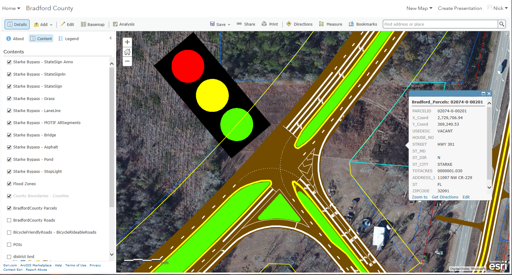
City of Starke, Florida Bypass
Shown below is an example of an ArcGIS Online map that was created for Bradford County which incorporates FLDOT data for a proposed bypass for the City of Starke. For the bypass dataset, FLDOT provided the County a CAD drawing in DGN format. The CEDRA Corporation converted this data into a file geodatabase and published a Feature Service containing the various layers comprising the bypass. In addition to the bypass, the map also contains the County’s parcel data layer along with a number of other layers|
|
 |
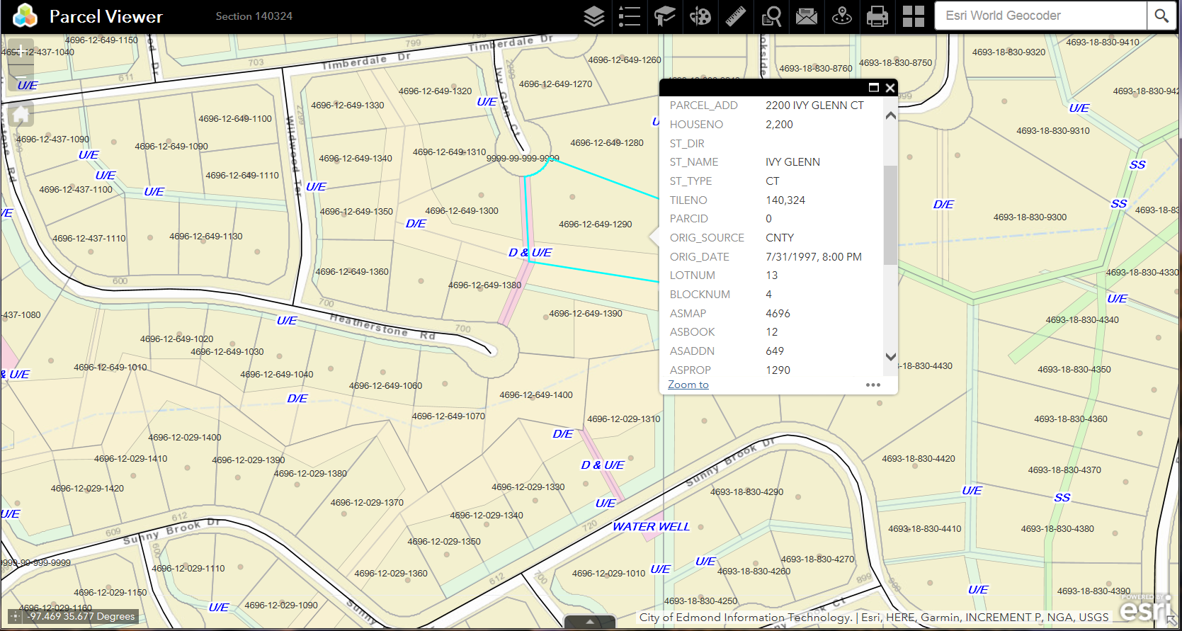
Parcel Viewing/Maintenance Application
For those interested in an ArcGIS Online Application for viewing and maintaining parcel information the application shown below is a perfect solution. Shown in the figure below is an application which offers the user: (a) identify, (b) drawing, (c) measuring, (d) querying, (e) public notification, (f) proxmity, (g) printing and (h) selection of various basemaps functionality. This application can be tailored to utilize a client's feature and map services. Layers such as easements, subdivision plats, address points, flood zones as well as any other type of layer can be incorporated into the application.Those interested in examining the application will definitely want to click on this link.
|
|
 |
Sewer and Water Utility Application
For those interested in an ArcGIS Online Application for viewing and maintaining water and sewer utilities the application shown below is a perfect solution. Shown in the figure below is an application which offers the user: (a) identify, (b) drawing, (c) measuring, (d) querying, (e) editing, (f) printing and (g) selection of various basemaps functionality. This application can be tailored to utilize a client's feature and map services. Layers such as parcels, easements, subdivision plats, address points, flood zones as well as any other type of layer can be incorporated into the application.Those interested in examining the application will definitely want to click on this link.
|
|
 |
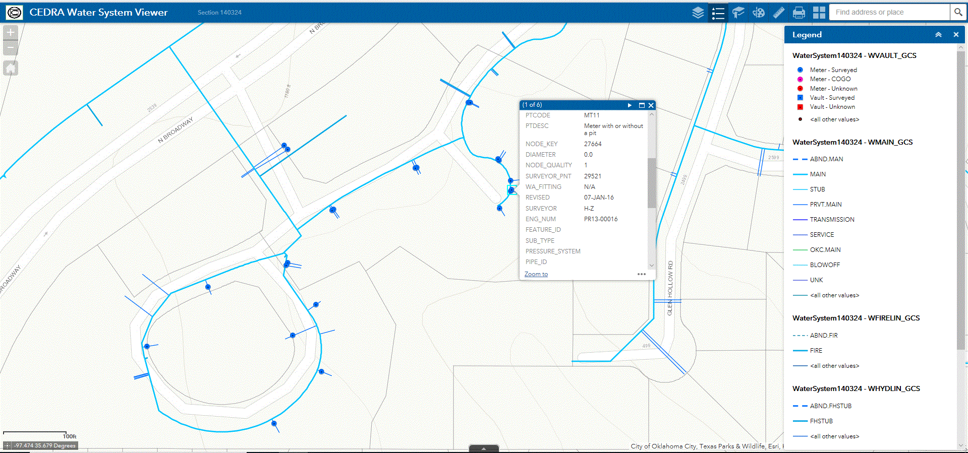
Water System Viewer Application
For those interested in an ArcGIS Online Application for viewing the elements comprising a Water System, the application shown below is a perfect solution. Shown in the figure below is an application which offers the user: (a) identify, (b) drawing, (c) measuring, (d) printing and (e) selection of various basemaps functionality. This application can be tailored to utilize a client's feature and map services. Layers such as parcels, easements, subdivision plats, address points, flood zones as well as any other type of layer can be incorporated into the application.Those interested in examining the application will definitely want to click on this link.
|
|
 |