About The CEDRA Corporation

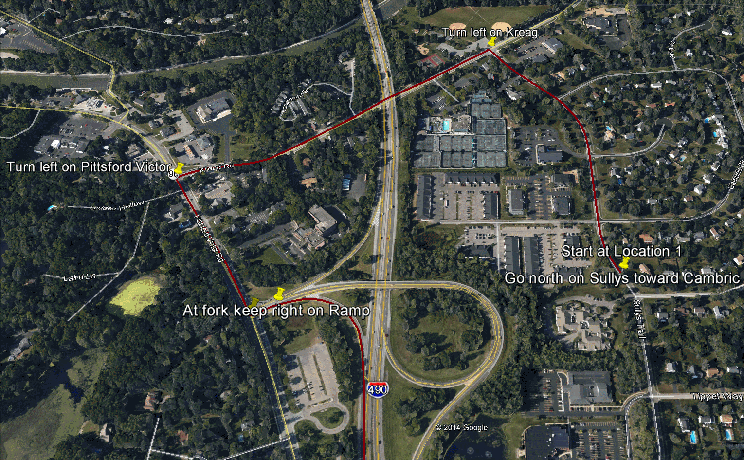
"Heavy Truck, Wide Load Routing, Albany, New York"
Overview
Incorporated in 1985, The CEDRA Corporation is a software developer
as well as a provider of consulting services to municipal (local, state and federal agencies)
and private organizations. CEDRA offers a wide range of consulting services including:
(a) needs assessments, (b) hardware and software implementation, (c) software development,
(d) data capture and maintenance and (e) system maintenance to name a few. CEDRA has been
installing and assisting users in maintaining their computing environments since its formation.
With hundreds of clients nation-wide, CEDRA has established a national presence
for offering GIS software and consulting services. CEDRA prides itself on providing
high-quality, production oriented software and ensuring their client's satisfaction with our
software and service. As such, CEDRA is highly responsive to a client's requests and
suggestions. A number of CEDRA's clients have been working with CEDRA for over 20 years.
The CEDRA Corporation offers Geographic Information Systems
(GIS) based software for mapping, civil engineering design and
modeling, surveying and database maintenance applications. CEDRA’s
AVseriesTM suite of software operates directly within Environmental
Systems Research Institute (Esri) GIS software (ArcGIS® 9.x and 10.x),
thus eliminating the need to switch
back and forth between various software packages. CEDRA software
is developed entirely in-house and marketed worldwide to public
works agencies, tax assessors, utilities, municipalities and private
sector companies.
Complementing CEDRA's Software Development Division is CEDRA's
Professional Services Division which has performed consulting
projects throughout the U.S. and specializes in developing, populating
and maintaining GIS databases, commonly referred to as data capture
and maintenance. CEDRA's Professional Services Division offers
consulting services for a multitude of applications. These applications
can pertain to assisting clients implement CEDRA software or can
be totally non-CEDRA software related consulting projects. CEDRA
staff is highly proficient in GIS Analysis, Data Capture, Data
Conversion, Map Production, Routing, Custom Application Development
be it Desktop or Server based and performing IT needs assessments.
As an authorized Esri business partner, CEDRA
has a long history in the use and application of Esri’s GIS
suite of software. CEDRA has been involved in developing software
and implementing solutions based upon Esri’s software since
1987.
CEDRA’s GIS based software provides the user: CAD, COGO,
Deed Transcription, Parcel Mapping, Surveying, Contouring, Traverse
Adjustment, Cross-Section and Profile Stripping/Plotting, Stakeout
data, Roadway Design, Earthwork Calculations, Site Development,
Plan and Profile Drawing Assembly, Sanitary, Storm, Combined Sewer
Modeling, Water Distribution Modeling, Data Editing/Maintenance
and DXF export functionality all within Esri’s ArcGIS software
environment. This software provides Surveyors, Civil Engineers,
Map Producers, Assessors and those involved with Utilities (sewer,
water, gas, oil, electric, etc.) a wide range of functionality
operating on the Esri ArcGIS platform.
CEDRA’s Professional Services Division, comprised of
a number of civil engineers, is highly specialized in developing
water, wastewater and storm sewer databases and converting existing
information (digital and non-digital) into Esri's GIS format.
CEDRA also has experience in developing databases for other types
of utilities such as electrical, oil and natural gas pipeline
facilities.
Typical CEDRA conversion projects involve taking surveyed
field information in conjunction with design or as-built drawings
and developing specific types of databases, such as street centerlines
and rights-of-way, parcels, easements, sewer, water, storm water
and other types of utilities. Each of these databases then serve
as individual layers which are used to create specific types of
maps and digital models. Custom mapping, querying and viewing
software is then developed to enable the client to interact with
the databases in a desktop or web based environment.
In addition to the utility projects described above, CEDRA’s conversion
projects have also included developing base maps for use in Enterprise
Asset Management systems such as the Nuvolo EAM platform. These projects
typically involve parsing architectural drawings into a Nuvolo compatible
DXF file which can be imported into the Nuvolo EAM platform.
As a privately held corporation CEDRA is able pursue development
and services projects that are aligned with its corporate goals
and needs of its clients. CEDRA's software development work is
primarily oriented towards the surveying, mapping, civil engineering
and data management fields. The services which CEDRA offers has
been primarily oriented in data capture, data maintenance and
custom application development.
During the last few years, however, CEDRA has expanded its
scope of services to include routing and network analysis. CEDRA's
work with the New York State Energy and Research Agency (NYSERDA)
and the Federal Highway Administration (FHWA) has involved developing
intelligent 3D GIS based roadway networks which can be used for
routing heavy and wide load vehicles as well as fuel efficiency
analysis.
CEDRA has formed strategic business relationships with Applied
Pavement Technology, Inc. and Terrametrix,
LLC who offer field collection services for pavements and
street assets, respectively. Both firms are leaders in their respective
fields and have performed projects worldwide. CEDRA partners with
these firms in developing and implementing Pavement Management
and Asset Inventory Systems which are integrated with a municipalities
GIS.
A case study describing the types of services CEDRA provides can
be found by clicking on this link.
This case study illustrates how CEDRA software and consulting
services are employed in asset collection and asset inventory
implementation.