CEDRA-AGsuiteTM
Comprehensive Software for Mapping, Design, Modeling, Data Maintenance...
CEDRA-AGsuiteTM is a package
comprised of the CEDRA-AVcad, CEDRA-AVcogo,
CEDRA-AVparcel, CEDRA-AVland,
CEDRA-AVsand, CEDRA-AVwater,
CEDRA-DataEditor and CEDRA-DxfExport
ArcGIS based software, which provides the user: CAD, COGO, Deed
Transcription, Parcel Mapping, Surveying, Contouring, Traverse
Adjustment, Cross-Section and Profile Stripping/Plotting, Stakeout,
Roadway Design, Earthwork Calculations, Site Development, Plan
and Profile Drawing Assembly, Sanitary, Storm, Combined Sewer
Modeling, Water Distribution modeling, Data Editing/Maintenance
and DXF export functionality. This software package provides surveyors,
civil engineers, mappers, assessors and those involved with utilities
(sewer, water, gas, oil, electric, etc.) a wide range of functionality
at a most affordable price. This package offers the user an alternative
to acquiring all of the above software packages individually.
So that for those who wanted specific functionality but were also
interested in some additional functionality but could not justify
the expense, the CEDRA-AGsuite package is a perfect solution.
CEDRA-AGsuite can be licensed in one of two modes: (a) Single
User License or (b) Site License. The Single User License
fee is $1,995 while the Site license fee is $2,995.
As the name indicates the single user license is intended for
operation on a single computer, while the site license enables
the user to operate the software on as many computers as desired
within a single building. Additionally, software support for the
single user license is available for $350, while software
support for the site license is $995. Software support
is an annual subscription that provides the user telephone, fax
and e-mail technical support, as well as software upgrades as
they become available. Software upgrades are available by download
via the internet.
To order the CEDRA-AGsuite software click on this link to view
and/or download the CEDRA-AGsuite order
form.
Click on this link for a color brochure,
which can be viewed and/or printed with Adobe Acrobat® ReaderTM.
Presented below is a brief description of the software comprising
the CEDRA-AGsuite package. Clicking on the triangle to the left of the software
expands/collapses the brief description, while clicking on the link for a software
displays a much more detailed description of the software.
Note if there is specific desired functionality that is currently
not available in the CEDRA-AGsuite software, The CEDRA Corporation
will work with the client to implement said functionality.
▼
CEDRA-AVcad
Provides more than 100 menu, button and tool commands for
creating and editing point, line, polyline, polygon and curve
features, and text strings in a CAD like environment. Because
of its robustness, CEDRA-AVcad™ can be thought of as a "lite"
COGO or Parcel Mapping product. Functionality includes but is
not limited to:
- Point snapping across visible themes, and control snapping tolerance,
- Working in feet, meters or varas, and bearings, azimuths or Cartesian directions,
- Create tangents, projections and offset features, and intersect lines, curves and polygons,
- Transform features from one coordinate system into another,
- Translate, rotate, scale and/or stretch groups of features,
- Deed transcription with or without tie lines, and adjustment of parcels and traverses by the compass or transit rules, and Crandall or least squares methods,
- Deed transcription by processing Aliquot descriptions,
- Create irregular buffer zones, and ring / sector polygons emanating from a point,
- Mass annotate point, line, curve and polygon features,
- Mass import points, lines, curves and polygons from various ASCII file formats.
|
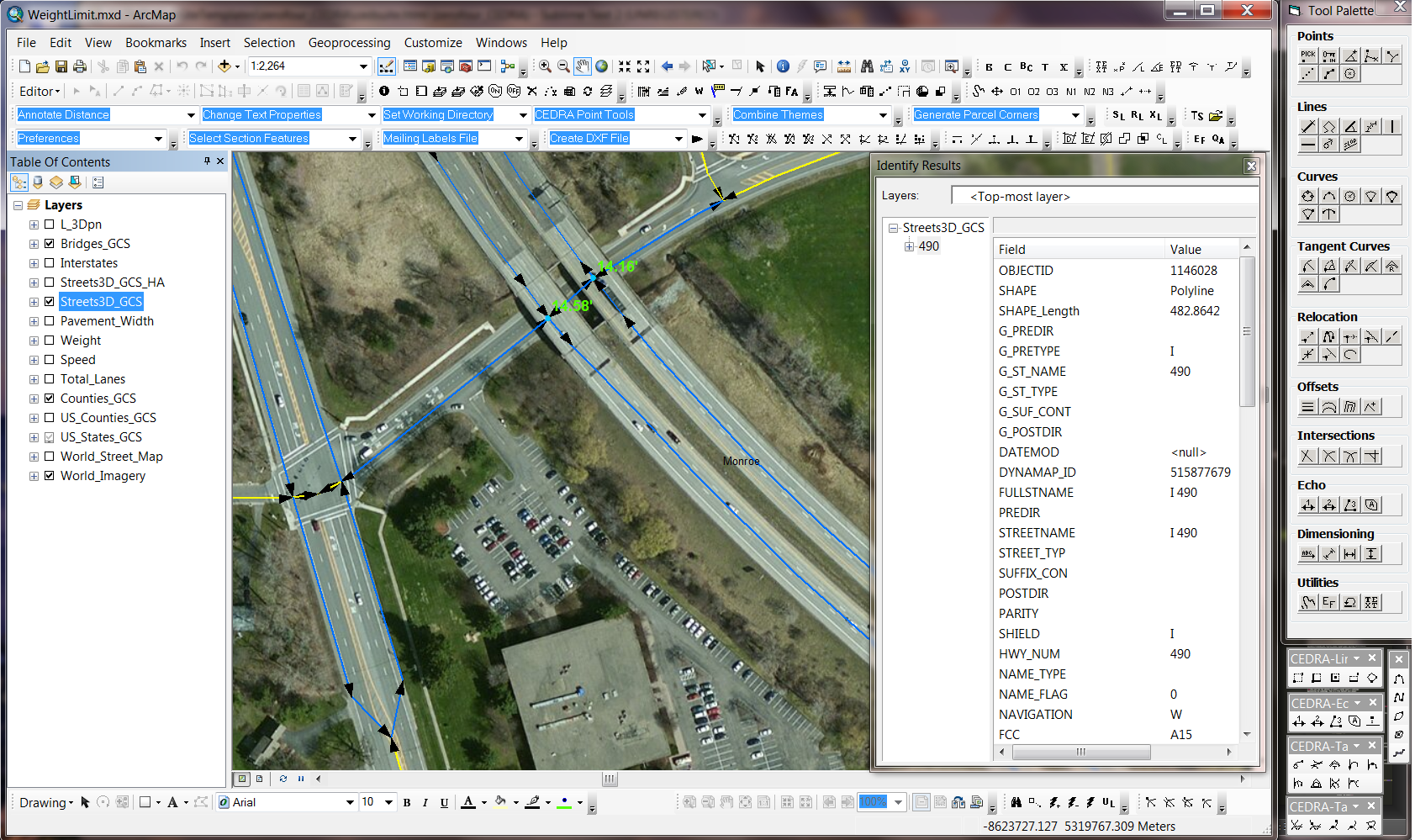
CEDRA-AVcad being used to establish and maintain Street Centerlines |
 |
▼
CEDRA-AVcogo
Provides a multitude of geometric commands to assist in the
creations and editing of points, lines, curves and polygons,
including intersections, tangencies, projections, and other geometric
operations. In all, more than 150 commands are available to the
user for creating and editing geometric and text features. Furthermore,
the user has the ability to create spirals
in a variety of methods which is ideal for those involved with
railroad companies and the like where spiral definitions are
prevalent.
This extension is of particular interest to those involved in
the building of base maps, in which geometric command flexibility
is desired in establishing precise geometric configurations of
existing or new features, and to those in general desiring an
extensive suite of commands to solve geometric problems. A three
dimensional database is supported.
|
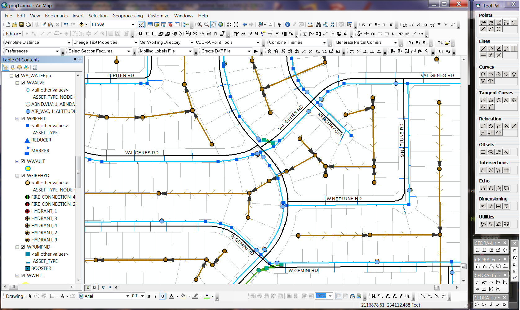
CEDRA-AVcogo being used to create and maintain various Municipal utilities |
 |
▼
CEDRA-AVparcel
Enables the user to create, edit and manage three dimensional
(high-rise condominiums) topological polygons of parcels for
tax (cadastral) mapping, parcel maintenance and other applications
that involve the manipulation of polygons and/or boundary information.
Functionality includes but is not limited to:
- Geometric layout of parcel corner and circular and spiral curvature points, boundary sides, polygons, and multi-course tie lines,
- Automatic determination of centroids and areas in State Plane, UTM, latitudes-longitudes, etc. coordinates,
- Polygon creation within a quadrilateral's rows and columns (Aliquots), and auto-search (tracing) of lines,
- Creation of parcel ownership, political boundary and various types of districts, and support of associated tables,
- Maintenance of computational and deed record attributes,
- Mass conversion of polygon parcels into a topological structure,
- Database query and editing, and parcel location by number and area range,
- Polygon splitting and joining, and editing of vertices,
- Customization of parcel attributes, topological data structure, and PIN's,
- Customized templates for map preparation for mass annotation of parcel metes and bounds, PIN's, areas and centroids.
|
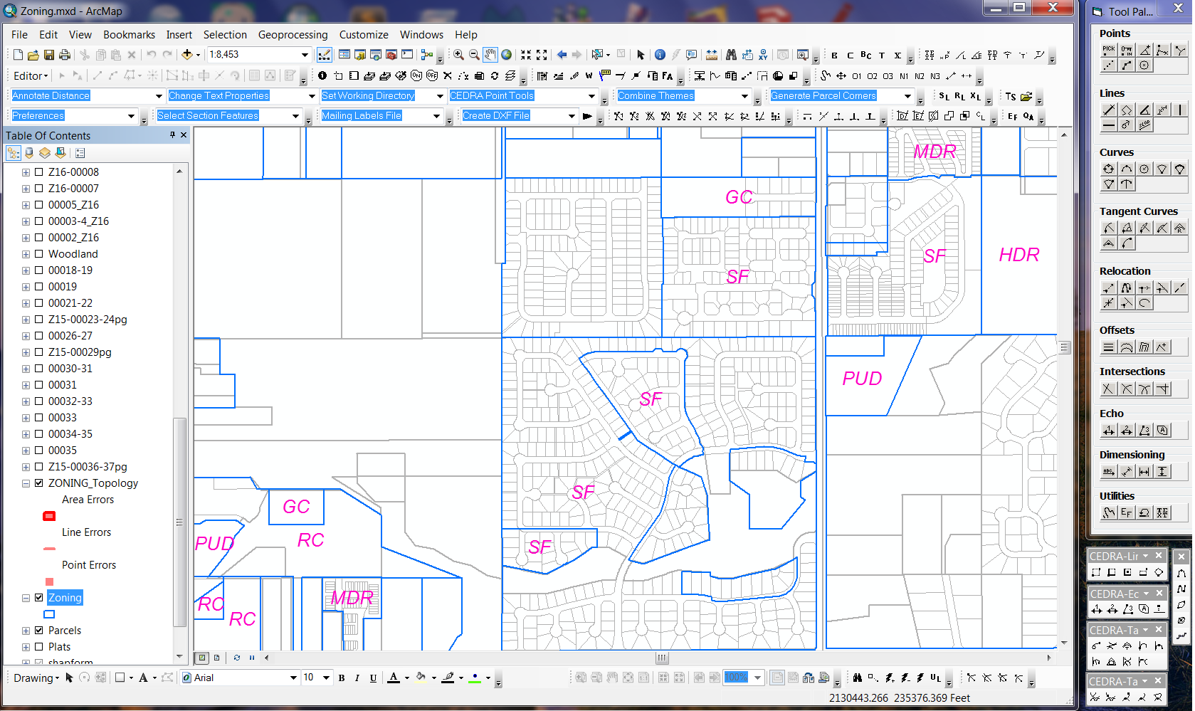
CEDRA-AVparcel being used to establish and maintain Zoning polygons |
 |
▼
CEDRA-AVland
Provides the engineer functionality to perform surveying,
COGO, contouring, traverse adjustments, stakeout, road design,
earthwork, tax mapping and site modeling applications in an environment
that integrates Civil Engineering and GIS. CEDRA AVland™
offers the engineer the ability to take a project from field
collection through design, construction and facility maintenance.
Functionality includes but is not limited to:
- Define an unlimited number of roadway design criteria,
- Design an unlimited number of:,
- Horizontal alignments with circular and/or spiral curves,
- Vertical alignments,
- Generate in mass,
- Stationing annotation, o Profile annotation,
- Horizontal curve tables, o Vertical curve tables,
- Use a variety of cogo tools for,
- General geometric design, o Automatic lot generation in accord with local zoning criteria,
- Building envelope creation, o Random points/odd stations,
- Draft or import typical roadway sections, and transition links,
- Generate, based upon design criteria,
- Pavement ribbons, o Right-of-way features,
- Cul-de-sacs and turnarounds,
- Generate fully annotated cross sections, and plan and profile drawings,
- Generate contours from random points and/or cross section data, and interface with ESRI's 3D Analyst™,
- Strip or extract cross sections and profiles from contour strings and/or 3D polygons,
- Compute earthwork with option of creating a formal report, and/or including quantities on cross section drawings.
|
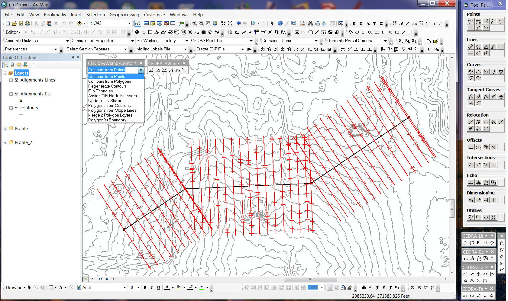
CEDRA-AVland being used to create Contours and Extract Cross-Sections and Profile |
 |
▼
CEDRA-AVsand
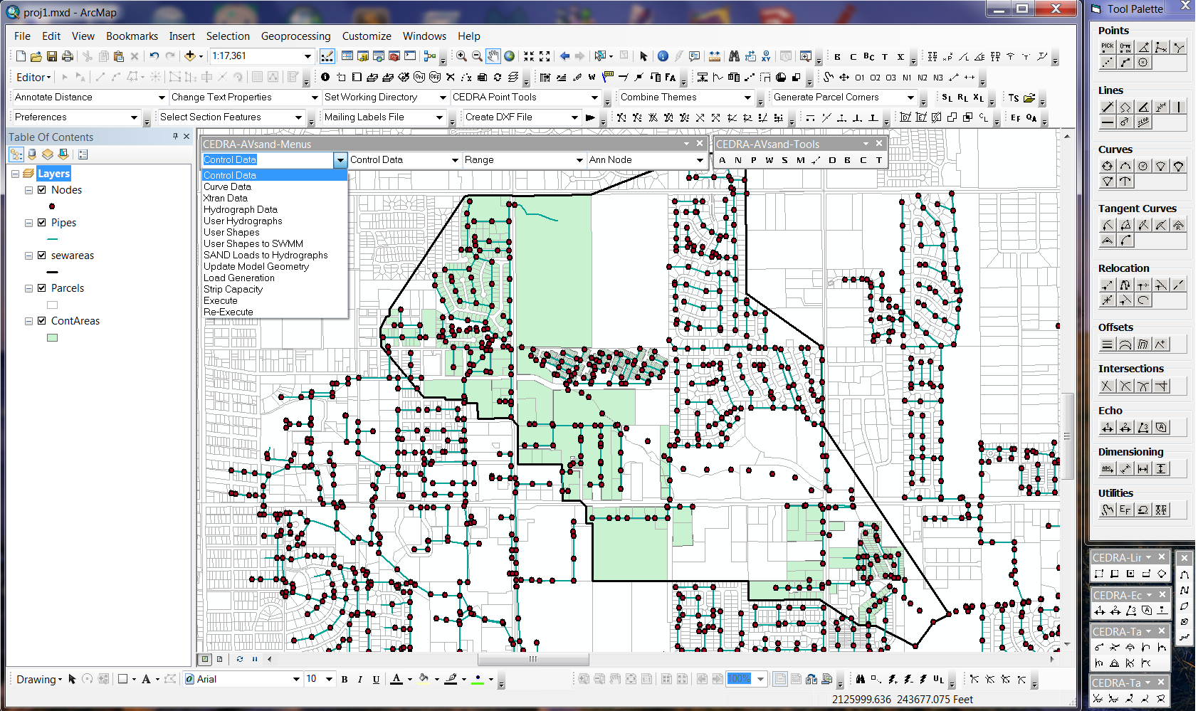
Enables the engineer to create the geometric model of a storm
water, wastewater or combined system, impose associated loads
applying custom peaking factors to average daily contributions
in US or SI units. Open channel and closed conduit flows may
be computed, system adequacy determined, flow hydrographs generated,
and stage-storage curves developed. Over thirty built-in conduit
shapes are available, as well as the ability to define custom
shapes. Static, dynamic, and backwater analysis with one of the
available modelers, CEDRA-AVsand™ or USEPA SWMM (Versions
4.31 and 4.4h). Some of the functionality includes:
- Define the model's geometry interactively, or by importing model data in a variety of file formats,
- Introduce loads with direct flow rates, inflow hydrographs, land parcels and/or building footprints,
- Database query and editing of hydraulic computational results, inventory features, operational and historic data,
- Interactively edit node and pipe attributes, inflow hydrographs,
- Interactively edit inflow hydrographs individually or by applying an equation to alter the flows in mass,
- Introduce siphons, diversions, parallel pipes and loops,
- Graphic display of hydraulic charts and tables, flow hydrographs, conduit and energy grade line profiles, and annotation of pipes and nodes with physical and computational data.
|
CEDRA-AVsand can be used to model Sanitary, Storm and Combined Sewers |
 |
▼
CEDRA-AVwater
Enables the engineer to define the geometric configuration
of a water distribution network, establish the materials inventory,
introduce supply and demand loads, perform analyses and display
pertinent results in graphic and/or tabular format in the US
or SI units. Storage tanks, pressure regulating, sustaining and
open/close valves, pumps, meters, etc. can be included in the
model. CEDRA-AVwater™ interfaces with the EPANET™ (Versions
1 and 2) modelers. Some of the functionality includes:
- Define the model's geometry interactively, or by importing existing EPANET, or Cybernet models, or model data in a variety of file formats,
- Introduce inflows, outflows and fire flow loads with direct rates, land parcels and/or building footprints,
- Database query and editing of hydraulic computational results, inventory features, operational and historic data,
- Static and extended period simulation for an unlimited number of pipes with the EPANET modelers,
- Graphic display and/or hydraulic and quality charts and tables, conduit and energy grade line profiles, pressure, grade line, flow and velocity contours, flow direction arrows, and annotation of pipes and nodes.
|
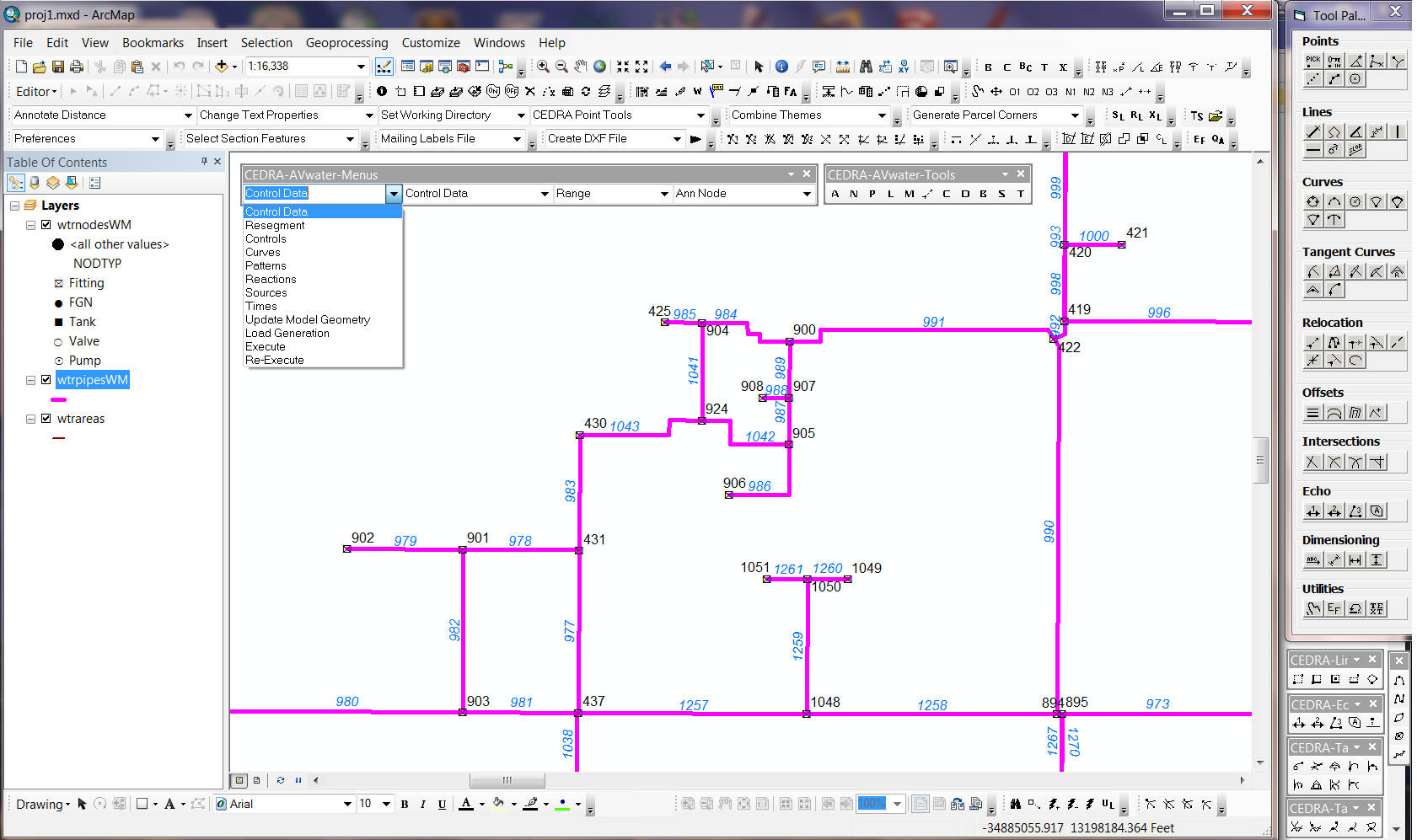
CEDRA-AVwater being used to create and maintain an EPANET water model |
 |
▼
CEDRA-DataEditor
Facilitates the editing of feature attribute data and is an
ideal tool for those involved with facility maintenance and/or
data capture applications, or for those who wish to enhance ArcGIS
native table editing functionality. The user creates an ASCII
based file, referred to as the Theme Attribute Data File, that
contains desired attribute labels and default values or equations
for each attribute within a theme to be edited. There is no limit
to the number of attributes or themes that can be specified.
Using the information in the Theme Attribute Data File the program
builds a custom single or multi-column dialog box containing
the values for the specified attributes. It is possible for a
feature to have:
- All of its attributes stored in the theme's attribute table, or
- Some of its attributes stored in the theme's attribute table, and others stored in an unlimited number of associated tables.
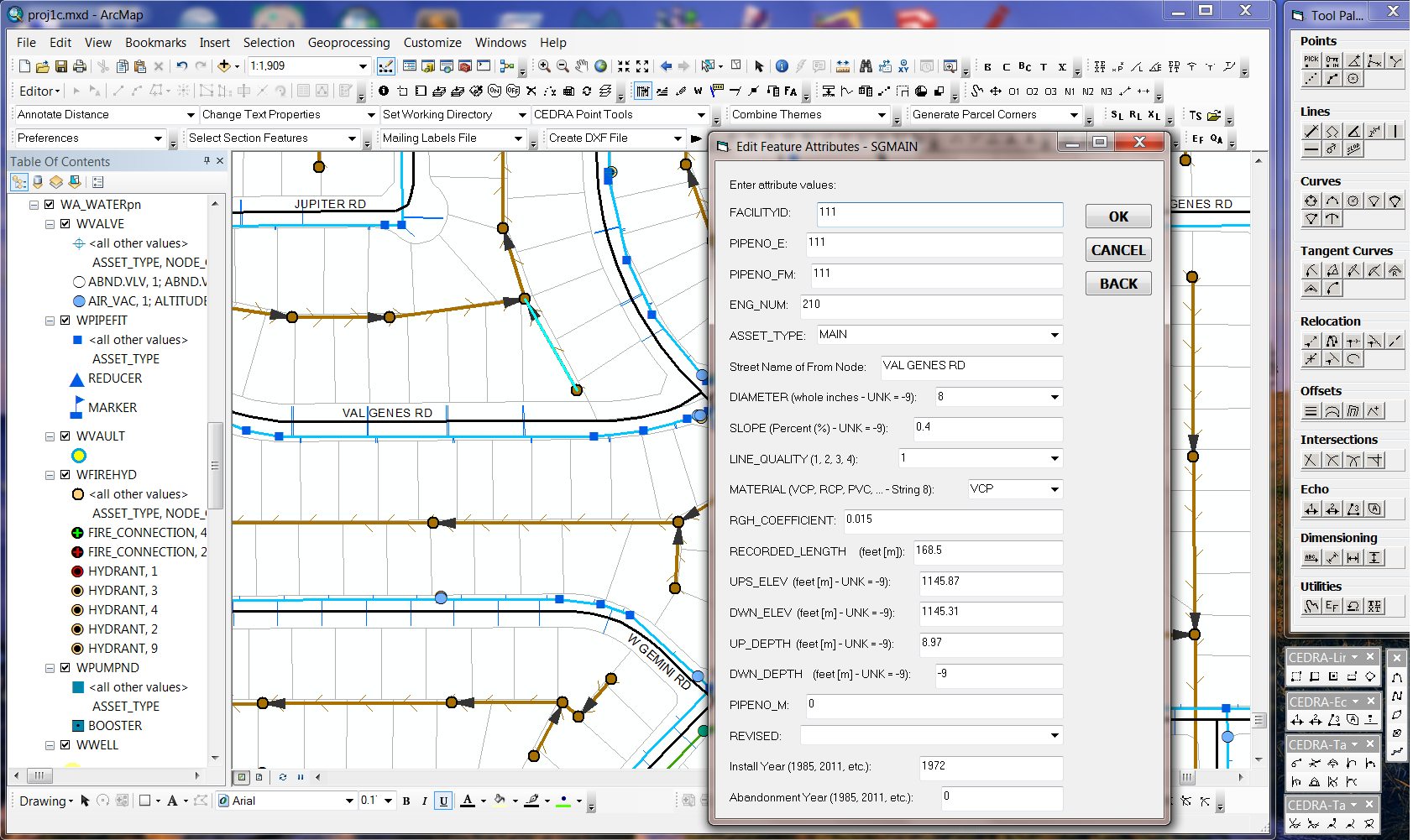
When the user selects a feature for editing, a customized dialog
box is displayed with the specified attribute labels and default
values. An attribute's default value may be a specific value,
or may be computed as the feature's area, perimeter or from a
host default options. Ranges of allowable numeric attribute values,
as well as, attribute drop-down lists may be specified. A Map Tips tool is also available providing
the user the option of displaying multi-line map tips with user-specified
labels to better identify the displayed value.
|
CEDRA-DataEditor being used to maintain attribute data using a User-Defined Form |
 |
▼
CEDRA-DxfExport
Enables the user to create an AutoCAD
Drawing Interchange File (DXF file) for all visible features
in the current map. Unlike other DXF export utilities, which
process only one theme (layer) at a time, the CEDRA-DxfExport™
software processes all visible themes (shapefiles, personal geodatabases,
enterprise geodatabases and coverages) from either Data View
or Layout View. In addition, the CEDRA DxfExport software will
process annotation features and graphic text elements. As such,
a DXF file created by CEDRA-DxfExport can include features and
text. In processing the visible feature and annotation layers
in the map, note the following:
- If a theme has selected features then only the selected features will be processed, if there are no selected features then all features in the theme will be processed. If the option Export Features displayed in the Current Extent is selected then all visible features in the current view will be exported regardless of the feature's selection state,
- If there are selected MARKER, PEN, FILL and/or TEXT graphic elements then these graphic elements will be processed (if the user desires) and placed in separate layers in the DXF file,
- The name of the theme will serve as the name of a layer in the DXF file,
- The user has the ability to select one or more attributes from a theme for inclusion in the DXF file, if desired. When exporting attributes, the selected attributes will appear as "blocks" in the DXF file.
- The user has the ability to export classes in a layer's classification as individual layers.
- The user has the ability to export a point layer's symbology maintaining the symbology. That is a fire hydrant will appear as a fire hydrant in the DXF file, not as a simple point.
- The user has the ability to define a color mapping file ensuring the desired color is maintained in the DXF file.
- The user has the ability to create a DXF file that maintains the line thickness for one or many user-specified layers.
- The user has the ability to perform exports in a batch environment.
|
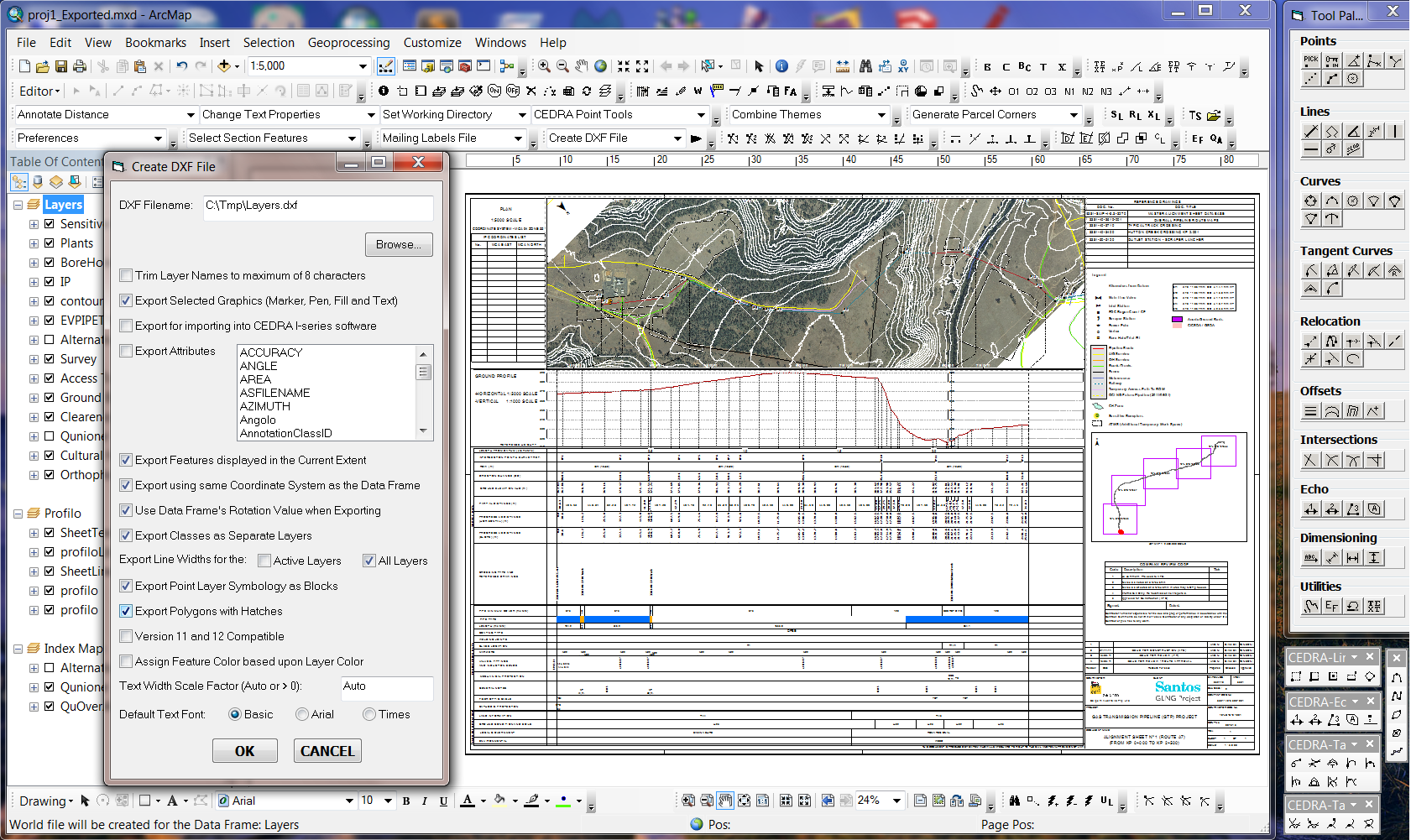
CEDRA-DxfExport being used to create a DXF file for the Layout View |
 |
To download a color brochure, which can be viewed and/or printed with Adobe Acrobat® ReaderTM, click on the following link CEDRA Software Information.
Click on this link to receive a CEDRA AGsuite order form.
CEDRA-AGsuite is licensed as per the terms of the CEDRA Software License Agreement.
Go Back to the CEDRA Homepage